Quick summary: Farmer & Plot Digitization for Agroforestry Projects: learn why first-mile data integrity matters, common data gaps, and how digital farmer profiling and plot mapping enable carbon, ESG, and compliance readiness.
Agroforestry projects succeed or fail at the first mile but this is where data is most often weakest. Farmer and Plot Digitization for Agroforestry Projects addresses this problem at its root. By digitally profiling farmers, accurately mapping plots and land features, and recording participation from day one, agroforestry initiatives create the data integrity needed for carbon accounting, ESG reporting, and long-term scalability.
Many programs invest heavily in trees, inputs, and monitoring, only to discover later that unclear farmer records, poorly mapped plots, or missing consent documentation undermine carbon claims, funding, or verification. Once these gaps surface, fixing them is slow, expensive, and sometimes impossible. In a landscape where buyers, registries, and donors demand verifiable impact, first-mile digitization is no longer optional it is the foundation of credible agroforestry outcomes.
Key Takeaways
Farmer and Plot Digitization in agroforestry is the process of digitally capturing, structuring, and validating data about participating farmers, their land parcels, and on-farm features such as plots, boundaries, and conservation structures to create a reliable, auditable foundation for agroforestry projects. This typically includes farmer profiling, GPS-based plot mapping using polygons, and documented participation or consent records linked to each plot.
In agroforestry, first-mile data integrity means that every tree, plot, and practice can be traced back to a real, verified farmer and a precisely mapped piece of land. Because agroforestry systems are dispersed, smallholder-driven, and long-term, weak first-mile data quickly leads to gaps that undermine carbon accounting, sustainability claims, and verification.
Digitization is therefore foundational for carbon, ESG, and compliance programs. Accurate farmer and plot data enable credible carbon baselines, support digital MRV (DMRV), prevent double counting or overlap, and provide the evidence required by carbon registries, donors, and corporate buyers. In short, farmer and plot digitization turns agroforestry from a collection of activities into a transparent, verifiable, and scalable climate solution.
Read our blog on Agroforestry Solutions for Carbon to understand how tree-based systems generate long-term, high-integrity carbon removals.
Dive into our guide on DMRV for Agroforestry and see how digital MRV enables scalable monitoring, verification, and registry-ready reporting for agroforestry projects.
Farmer profiling is the backbone of trust and verification in agroforestry initiatives. Because agroforestry projects rely on long-term participation and distributed land management, accurately identifying who is involved and under what conditions is essential for credibility, accountability, and impact.
Effective farmer profiling in agroforestry projects typically covers:
See how seamless KYC transforms farmer onboarding
Read the case study on Enhancing Farmer Onboarding with Integrated KYC Validation to learn how digital verification improved data quality, reduced onboarding time, and strengthened compliance at the first mile.
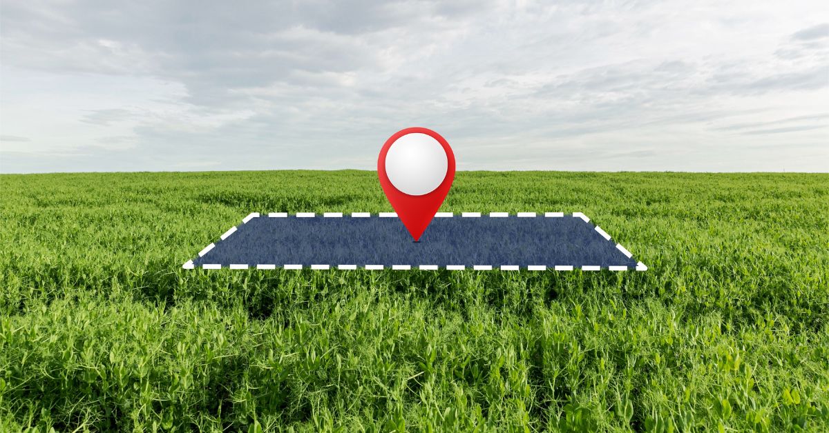
Accurate plot mapping is a core technical requirement for agroforestry projects, especially those linked to carbon accounting, ESG reporting, or climate finance. Because agroforestry systems are spatially complex and often fragmented, precise plot-level data is essential to ensure credibility and verification.
Plot boundary mapping goes beyond capturing a single GPS point. GPS polygon capture records the full boundary of a plot, reflecting its true size and shape, while point coordinates only indicate an approximate location. For agroforestry, polygons are critical because they allow verifiers to calculate land area accurately, assess land-use change, and link carbon outcomes to specific parcels.
High-quality mapping accounts for plot size, shape, and spatial accuracy, reducing the risk of under- or over-reporting land area. This is especially important where smallholder plots are irregular, adjacent, or split across multiple parcels. Effective systems also support fragmented and intercropped plots, enabling multiple crop and tree systems to be mapped within a single farm without losing traceability.
Once plots are mapped, geo-validation ensures spatial integrity. This includes preventing boundary overlap between plots within the same project or across neighbouring projects, which is a common cause of double counting and credit rejection. Validation checks also help verify land-use eligibility, confirming that plots meet project rules and regulatory cut-off dates.
Aligning plot data with satellite imagery further strengthens credibility. Satellite overlays allow project teams and verifiers to cross-check boundaries, detect land-use change, and monitor tree establishment over time. Together, plot mapping and geo-validation create a defensible spatial foundation that supports agroforestry projects from implementation through long-term verification.
Bunds are raised earth embankments or contour structures built along field boundaries or slopes to manage water flow, reduce erosion, and improve soil moisture. In agroforestry landscapes especially in smallholder and rain-fed systems bunds play a critical role in shaping how land, trees, and water interact over time. Yet, they are often invisible in traditional farm maps, creating blind spots in both land management and carbon accounting.
Bunds directly influence soil conservation, water retention, and tree survival. By slowing runoff and capturing rainwater, they reduce topsoil loss, improve nutrient retention, and create favourable micro-conditions for tree establishment. In agroforestry systems, these effects translate into healthier biomass growth and more stable carbon sequestration outcomes.
Digitally mapping bunds makes these benefits measurable and verifiable. Bund mapping helps:
Bund mapping improves plot accuracy by capturing functional land features that define how a plot actually performs, not just where it is located. It strengthens carbon accounting by supporting more accurate assumptions around soil carbon stability and biomass growth. Over time, this contributes to long-term project resilience, reducing the risk of tree mortality, yield loss, or carbon reversal.
In regions where irrigation is limited and rainfall is variable, bunds are foundational to agroforestry success. For smallholder and rain-fed systems across Africa, South Asia, and Southeast Asia, bund mapping provides region-adaptable evidence of land management practices that support climate resilience, farmer livelihoods, and durable carbon outcomes.
Many agroforestry projects struggle not because of poor intent, but because critical first-mile data is incomplete or inconsistent. These gaps often surface late during verification, audits, or credit issuance when they are hardest and most expensive to fix.
These gaps commonly lead to verification failures, including rejected carbon credits, audit findings, delayed funding, or the inability to scale projects beyond pilot phases.
Digitization turns fragmented field data into structured, verifiable evidence that supports multiple compliance and sustainability objectives.
By capturing accurate farmer and plot data, projects can transform on-ground activities into:
Digitized plots play a central role in modern sustainability systems. They feed directly into digital MRV (DMRV) workflows, support registry reporting requirements, and enable corporate insetting programs that rely on traceable, farm-level impact within supply chains. Without digitization, these systems lack the spatial and governance integrity required for approval.
TraceX DMRV Solutions enables agroforestry projects to digitize the first mile in a way that is both rigorous and scalable.
The platform supports:
Designed for multi-country agroforestry programs, TraceX allows project developers, NGOs, and corporates to standardize data collection, reduce verification risk, and scale credible agroforestry initiatives without losing first-mile integrity.
Farmer & Plot Digitization for Agroforestry Projects is no longer a technical add-on it is the foundation of credible, scalable, and fundable agroforestry initiatives. By accurately profiling farmers, mapping plots and land features, recording consent, and validating spatial data from the start, projects can avoid verification failures and unlock long-term value. As carbon standards, ESG programs, and climate finance increasingly demand proof at the farm level, first-mile digitization is what turns agroforestry from intention into verifiable impact.
Read our blog on Polygon Mapping to learn how accurate plot boundaries prevent overlap, support carbon accounting, and stand up to audits.
Explore Agroforestry for Sustainable Agriculture and see how integrated tree–crop systems deliver productivity, resilience, and sustainability at scale.
Dive into our guide on Farm Mapping for Compliance to understand how geospatial data underpins carbon standards, ESG reporting, and regulatory readiness.
It is the process of digitally capturing farmer profiles, land ownership or use details, plot boundaries (via GPS polygons), and participation records to create a verifiable foundation for agroforestry projects.
Accurate plot mapping prevents overlap, supports carbon accounting, verifies land eligibility, and enables reliable monitoring of tree growth and land-use change.
It links carbon outcomes to accountable participants, prevents duplicate claims, supports benefit sharing, and meets verifier and registry requirements.
Projects may face carbon credit rejection, audit failures, disputes over land or participation, and an inability to scale or secure funding.
Yes. With standardized digital tools and workflows, agroforestry programs can digitize farmers and plots consistently across regions while adapting to local land and governance contexts.