Quick summary: Discover how farm mapping solutions are transforming Nigeria’s smallholder agriculture. Digitize plots, enhance traceability, ensure compliance, and unlock market access for cocoa, cashew, ginger, hibiscus, and sesame farmers.
Farm Mapping in Nigeria is transforming agricultural productivity by digitally capturing farm boundaries, GPS coordinates, crop types, and farmer identities. With over 70% of Nigeria’s farmers operating small plots, mapping provides accurate land-size measurements, prevents input fraud, improves extension targeting, and enables access to finance and insurance. Digitized plots also support traceability for export crops such as cocoa, sesame, and ginger, ensuring compliance with emerging regulations like EUDR. As governments, agribusinesses, and NGOs scale geospatial mapping, Nigeria moves toward data-driven agriculture that boosts yields, transparency, and farmer inclusion.
Smallholder farmers form the backbone of Nigeria’s agricultural sector, representing about 70% of the total farming population and contributing significantly to national food production. Despite their importance, most smallholders operate on fragmented plots averaging 0.5–2 hectares, with limited or no formal documentation of land boundaries. This lack of visibility creates challenges for buyers, financial institutions, and processors who depend on reliable farm-level data for sourcing, credit decisions, and compliance with global standards.
Land tenure remains a major bottleneck, customary ownership systems, overlapping claims, and unresolved boundary disputes contribute to inefficiency and discourage long-term investment in the land. Because many farms lack geolocation records or verified plot maps, rural communities are unable to fully integrate into modern value chains that demand traceability, sustainability, and digital identities.
Nigeria’s diverse agro-ecological zones give rise to a wide range of dominant crops. Nationally important crops include maize, cassava, rice, sorghum, millet, yam, soybeans, sesame, cocoa, oil palm, and horticulture (tomato, pepper, onions). Specific regions specialize in certain value chains cocoa in the South-West, oil palm in the South-South, rice across the North and Middle Belt, and sesame and sorghum in the North.
Together, these structural gaps fragmented landholdings, undocumented plots, weak land governance, and low farm-level visibility underscore why digital farm mapping is rapidly becoming essential to unlocking productivity, financing, and market access for millions of Nigeria’s smallholders.
Ensure regulatory readiness and traceable sourcing with smart farm mapping. Learn how mapping every plot can streamline compliance and reduce risk across your supply chain.
[Explore the Blog →]
Digitally profile farmers to capture verified data, improve traceability, and strengthen ESG and sustainability reporting. Discover how digital onboarding empowers both farmers and buyers.
[Read the Blog →]
Digitizing farms with GPS coordinates, mapped boundaries, and verified farmer identities enables governments and private agro-input companies to target interventions accurately. Nigeria loses millions annually to ghost beneficiaries, duplicate registrations, and misallocated fertilizer subsidies. With mapped plots, policymakers can:
Banks and microfinance institutions struggle to lend to farmers because most lack formal land documentation, verifiable farm sizes, or historical yield data. With digitized farm maps:
Nigeria faces increasing climate threats droughts in the North, flooding in coastal zones, and unpredictable rainfall patterns across the Middle Belt. Digitized plots enable:
Nigeria’s burgeoning export sectors of cocoa, sesame, ginger, hibiscus, and rough cashew have driven significant growth in agricultural revenues, with Q1 2025 exports reaching ₦1.7 trillion ($1.079 billion), up 64.65% year-over-year, led by cocoa at over ₦1.2 trillion. Cocoa surged 606% in late 2024 to ~$777 million and continued dominating in 2025 with a 3,000% five-year rise, fueled by high global prices and naira depreciation, while rough cashew hit $398 million in H1 2025 (+81% YoY). Sesame contributed ~$454 million in 2024 as Africa’s second-largest exporter, hibiscus led global shipments at ~$10 million, though ginger dipped 74% to $4 million amid production challenges from blight. These commodities underscore Nigeria’s non-oil diversification push, targeting EU markets amid EUDR compliance needs, with cashew and sesame ranking among top performers at ₦158 billion and ₦128 billion respectively in Q1 2025.
Digitized plots not only strengthen Nigeria’s competitive edge but also protect exporters from rejection risks in high-value markets.

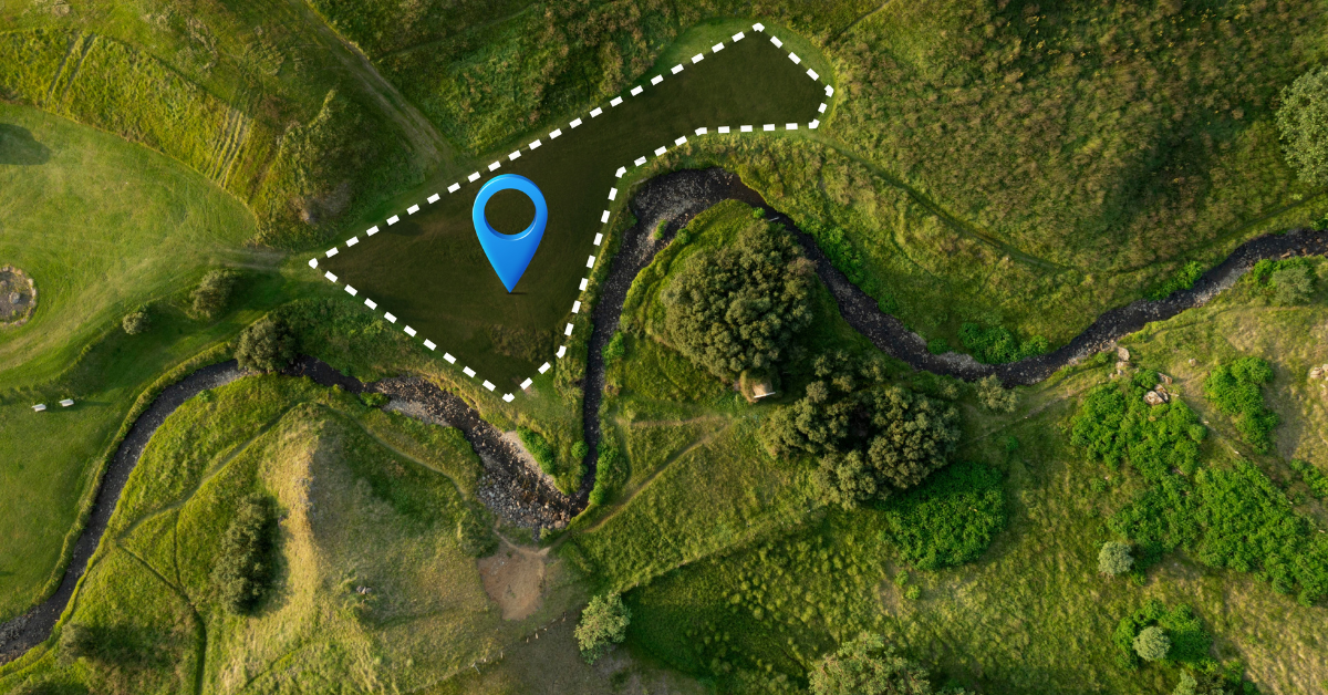
Farm mapping in Nigeria uses a combination of GIS tools, mobile data collection, remote sensing, and where required high-resolution drone surveys to digitize smallholder plots with accuracy and verifiable geolocation. This ensures that each farm has a unique digital identity that can be used for traceability, financing, climate-risk monitoring, and government support programs.
Capturing polygon boundaries
Enumerators or extension agents walk the perimeter of each farm using handheld GPS devices or mobile apps. The system records latitude–longitude points and converts them into polygon boundaries that define plot size, shape, and precise location. This eliminates guesswork and resolves common land-boundary disputes.
Mobile data collection tools
Platforms like TraceX, collect farmer demographics, crop data, input usage, soil characteristics, and photos synchronizing everything into a centralized database. Offline functionality is crucial for rural Nigeria where network coverage is limited.
NDVI vegetation analysis
Normalized Difference Vegetation Index (NDVI) from satellite imagery shows crop vigor, stress levels, canopy cover, and disease patterns. This helps government agencies and agribusinesses monitor farm performance across large areas without physical visits.
Crop type & stress detection
Machine-learning models classify crops (e.g., maize, cassava, rice, sorghum, cocoa) and detect anomalies like drought stress, nutrient deficiency, or pest attacks. This gives buyers, processors, and financial institutions early warnings and accurate production forecasts.
Cocoa, oil palm, cashew, tomato clusters
Drones provide centimeter-level detail for tree-crop plantations and horticulture clusters. They help assess tree counts, age distribution, canopy density, missing stands, and yield potential—data critical for export crops like cocoa, cashew, and oil palm.
Plant health insights
Multispectral drone cameras detect chlorophyll levels, water stress, fungal disease spread, and pest infestation with far higher precision than satellites. This supports precision-agriculture decisions, reduces losses, and improves sustainability for commercial buyers and aggregators.
Northern Nigeria
Northern Nigeria accounts for over 60% of Nigeria’s total cultivated land, with states like Kano, Kaduna, Katsina, Kebbi, Jigawa, and Borno serving as major crop production belts.
Key focus crops include:
Southern Nigeria
Southern Nigeria has denser rural populations and more tree-crop value chains, making mapping essential for traceability and EUDR compliance.
Key crops include:
Niger Delta Region
The Niger Delta’s agriculture is dominated by community-owned clusters, multi-layered farmlands, and wetland ecosystems.
Major crops include:
Key characteristics:
Farm mapping is now essential across Nigeria’s agricultural ecosystem, serving multiple stakeholders who rely on accurate, geotagged farm data to improve planning, sourcing, and decision-making:
Digitizing smallholder farms in Nigeria is essential but several structural and operational barriers slow down nationwide adoption.
A large share of Nigeria’s farming communities still experience limited mobile network coverage and unreliable internet access. This affects the transmission of geospatial data, real-time map syncing, and onboarding farmers onto digital platforms. Offline-first mobile tools and lightweight data capture methods are therefore critical.
Most smallholders operate on inherited, communal, or informally allocated land. The absence of cadastral records, title deeds, and clear boundary documentation leads to disputes and complicates polygon-level mapping. Digital mapping must integrate community validation methods to verify land boundaries.
GPS devices, drones, satellite subscriptions, and trained field agents involve significant investment. For many smallholders—over 70% of whom live at subsistence or near-subsistence levels—these costs are prohibitive. Scalable, cost-efficient mapping models and government or donor-backed programs are required.
Nigeria’s agricultural workforce spans hundreds of languages and dialects, with Hausa, Yoruba, Igbo, and Pidgin dominating in different regions. Digital mapping tools must support multilingual interfaces and culturally aware onboarding to ensure adoption by farmers across diverse communities.
TraceX Farm Management Platform provides a full-stack digital infrastructure that enables accurate, scalable, and compliant farm mapping across Nigeria’s diverse agricultural regions. The platform is designed to support governments, NGOs, processors, and financial institutions with real-time visibility into farmer networks and crop production systems.
TraceX’s field app allows extension agents and enumerators to digitally map farm boundaries using GPS-enabled polygon capture. This ensures each smallholder plot is registered with precise geolocation, a key requirement for subsidy programs, sourcing, and export compliance.
Every mapped plot is linked to a verified farmer profile capturing demographics, ID documentation, access to inputs, crops grown, historical yields, and social metrics. This enables lenders, processors, and government programs to make data-driven decisions based on validated farmer identities.
The platform integrates satellite imagery to generate NDVI vegetation scores, detect crop stress, assess growth patterns, and forecast yield. These insights support climate-smart planning, input advisory, and early warning systems for both smallholders and buyers.
TraceX uses blockchain to securely store geolocation, crop records, and farm-level sourcing data, creating an immutable chain-of-custody. This gives exporters verifiable proof of deforestation-free sourcing and meets global compliance standards such as EUDR, Organic, and Rainforest Alliance.
From the farm to aggregators, processors, and exporters, TraceX links every transaction and movement of produce. Buyers gain complete visibility into who grew what, where, and how, enabling transparent sourcing, reduced fraud, and stronger market access for Nigerian commodities.
Farm mapping is no longer optional it is the backbone of Nigeria’s transition to fully digital agriculture. By capturing georeferenced farm boundaries and verified farmer identities, Nigeria can finally unlock accurate data for planning, improve productivity, and eliminate inefficiencies that have long held the sector back. Digitally mapped farms also create the foundation for sustainability programs, climate-smart advisory, and export traceability requirements that are rapidly becoming mandatory under global regulations like the EUDR.
As climate risks intensify and market standards rise, Nigeria’s ability to compete globally will depend on how quickly it can digitize its millions of smallholder plots. The future of Nigerian agriculture more resilient farmers, stronger supply chains, and globally compliant exports begins with nationwide digital mapping.
Unlock the full potential of your farm! Explore our comprehensive guide to farm management and discover strategies to boost productivity, streamline operations, and enhance traceability.
Digitize your farm for a sustainable future! Learn how farm management software can help smallholders and agribusinesses monitor crops, ensure compliance, and meet global sustainability standards.
See your farm like never before! Discover how GIS technology is transforming agriculture with precise farm mapping, crop monitoring, and data-driven decision-making for higher efficiency and traceability.
Farm mapping involves digitally capturing the location, boundaries, and details of smallholder plots using GPS or GIS tools to improve traceability and compliance.
It helps verify land access, monitor crop production, ensure compliance with export regulations, and strengthen access to premium global markets.
Key export crops such as cocoa, cashew, ginger, hibiscus, and sesame benefit significantly from plot-level digitization for traceability and quality monitoring.
Digitized farm data allows verification of environmentally responsible practices, deforestation-free sourcing, and ethical smallholder engagement.
Yes. By providing verifiable origin data, farm mapping increases buyer confidence, reduces compliance risks, and helps exporters meet international standards.