Quick summary: Discover how farm mapping solutions are transforming Ethiopia’s smallholder agriculture. Digitize plots, enhance traceability, ensure compliance, and unlock market access for cocoa, cashew, ginger, hibiscus, and sesame farmers.
Farm Mapping in Ethiopia is essential for improving traceability, productivity, and climate resilience across the country’s predominantly smallholder farming sector. By digitizing plot boundaries using GPS, GIS, and remote sensing, Ethiopia gains precise farm-level data needed for input targeting, land governance, financial inclusion, and export compliance. Digital mapping also strengthens value chains for key crops such as coffee, sesame, teff, and pulses by enabling geolocation-based verification and yield monitoring. As Ethiopia scales modern agriculture systems, farm mapping provides the foundational data required for national planning, sustainability programs, and market access.
Smallholder farmers dominate Ethiopia’s agriculture, accounting for over 80% of producers and supplying the majority of national food output. Yet most operate on fragmented plots of 0.3–2 hectares with limited formal land documentation. This lack of mapped boundaries creates major challenges for buyers, lenders, and processors who require verified farm-level data for sourcing, credit assessment, and compliance.
Land tenure managed through customary systems, shared-use arrangements, and regional land proclamations remains complex. Overlapping claims, undocumented boundaries, and low adoption of digital land records hinder investment and impede integration into modern value chains demanding traceability and sustainability assurance.
Ethiopia’s diverse agro-ecological zones support key crops such as teff, wheat, barley, maize, sorghum, coffee, sesame, pulses, and horticulture. Regions specialize in distinct value chains coffee in Oromia and SNNPR, sesame in Amhara and Tigray, wheat in Oromia, and horticulture around the Rift Valley.
Combined, these challenges fragmented holdings, weak boundary documentation, inconsistent land governance, and low geospatial visibility underscore why digital farm mapping is becoming essential for Ethiopia. It enables productivity gains, financial inclusion, compliance with export standards, and stronger market access for millions of smallholders.
Below is the regenerated version fully adapted for Ethiopia, keeping structure, clarity, and relevance while removing Nigeria-specific details.
Ensure regulatory readiness and traceable sourcing with smart farm mapping. Learn how mapping every plot can streamline compliance and reduce risk across your supply chain.
[Explore the Blog →]
Digitally profile farmers to capture verified data, improve traceability, and strengthen ESG and sustainability reporting. Discover how digital onboarding empowers both farmers and buyers.
[Read the Blog →]
Digitizing Ethiopian farms with GPS boundaries and verified farmer identities enables government agencies and co-operatives to deliver fertilizer, improved seeds, and extension support more accurately. Ethiopia’s subsidy and input programs often face challenges such as beneficiary duplication, opaque landholding records, and inefficient distribution. With mapped plots, policymakers can:
● Match inputs to actual farm sizes and crop types
● Track usage and improve transparency in subsidy programs
● Eliminate fraud and reduce leakage across regional distribution chains
Most Ethiopian smallholders lack formal land certificates, verified acreage, or farm-level records making lending risky for banks and MFIs. Digitized farm maps allow:
● Verification of farm location, size, and crop type
● Data-driven farmer risk profiling
● Parametric/index insurance products tied to mapped coordinates
This strengthens creditworthiness and expands access to finance, especially in coffee, sesame, teff, wheat, and horticulture value chains.
Ethiopia is highly climate-vulnerable, facing recurrent droughts, erratic rainfall, soil degradation, and rising temperature stress. Digitized plots enable:
● Continuous monitoring of soil moisture, vegetation health, and crop stress
● Early-warning alerts for drought, pests, or diseases
● Zone-specific climate adaptation plans based on geospatial data
This supports government programs like the Green Legacy Initiative and climate-resilient agricultural development.
Ethiopia’s major export commodities coffee, sesame, pulses, spices, and cut flowers have generated over $3 billion in agricultural export revenue in the past ten months through mid-2025, with coffee alone driving $2 billion from 400,000 tons exported, fueled by reforms, high global prices, and surging demand in the EU, US, and Middle East markets requiring robust traceability and sustainability data under regulations like EUDR. Coffee earnings hit a record $2.65 billion in the prior fiscal year (up from $1.43 billion) with 469,000 metric tons shipped, and Q1 2025/26 added $762.75 million (+47% YoY), while sesame, pulses, and spices contribute significantly as oilseeds and key agri-exports alongside horticultural products like cut flowers. These sectors underscore Ethiopia’s push for $9.4 billion total exports in the new fiscal year, emphasizing digital traceability, certifications, and pest management to meet stringent global standards amid 104% goods export growth.
With farm mapping:
● Exporters can prove origin, land-use legality, and deforestation-free sourcing
● Buyers gain confidence through plot-level traceability
● Producers avoid border rejection and strengthen competitiveness
Digitized plots help Ethiopia meet growing compliance demands, including EUDR, Organic, Rainforest Alliance, and specialty coffee standards.

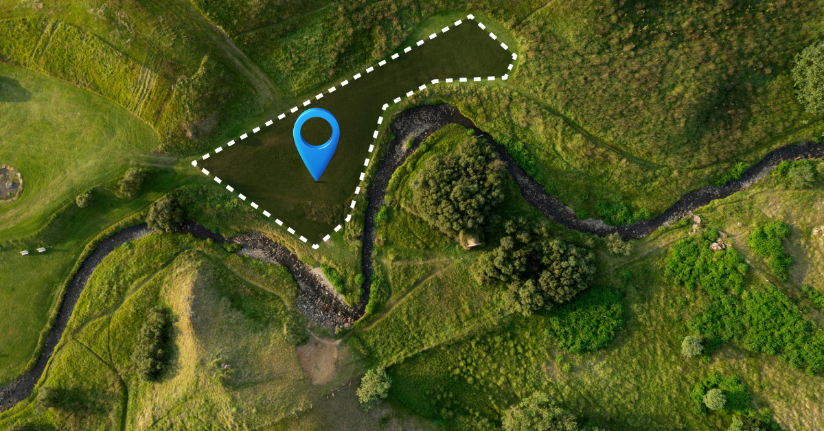
Farm mapping in Ethiopia applies GIS technology, mobile-based data collection, remote sensing, and high-resolution drone surveys to digitize smallholder plots with accurate geolocation. This creates a unique digital identity for each farm, supporting traceability, financing, climate-risk monitoring, and compliance across Ethiopia’s agriculture sector.
GIS & GPS-Based Mapping
Enumerators or extension agents walk farm perimeters using handheld GPS devices or mobile mapping apps to record latitude–longitude points. These are converted into polygon boundaries that define the exact plot size, shape, and location critical in regions with communal or overlapping land-use systems.
Platforms like TraceX capture farmer demographics, crop information, input usage, soil data, photos, and land tenure details, syncing everything into a centralized database. Offline functionality is essential in rural Ethiopia where connectivity can be limited.
Remote Sensing & Satellite Imagery
NDVI from satellite imagery helps monitor crop vigor, stress patterns, canopy cover, and disease hotspots across Ethiopia’s diverse agro-ecological zones, reducing the need for frequent field visits.
Machine-learning models classify major Ethiopian crops teff, coffee, maize, sorghum, wheat, sesame and detect anomalies like drought stress, nutrient deficiency, or pest outbreaks. This supports early warnings, yield forecasting, and buyer planning.
Drone Mapping for High-Value Crops
High-resolution drone imagery provides centimeter-level detail for Ethiopia’s flagship export crops. For coffee and sesame, drones assess tree/plant density, age distribution, canopy vigor, and missing stands data crucial for certification and export compliance.
Multispectral drone sensors detect chlorophyll levels, water stress, fungal disease spread (such as coffee wilt), and early-stage pest infestation with precision far beyond satellite capabilities. This enables targeted interventions and improves sustainability for cooperatives and commercial buyers.
Northern Ethiopia is a key grain and pulse-producing zone with mixed crop–livestock systems and highly fragmented smallholder plots.
Major crops include:
● Teff – Ethiopia’s most important cereal
● Wheat – large irrigated and rainfed belts
● Barley – dominant in highland areas
● Lentils & chickpeas – major export pulses
Key mapping challenges include rugged terrain, communal grazing land, and restoration landscapes that require clear boundary verification.
Oromia is Ethiopia’s agricultural powerhouse, covering coffee, cereals, oilseeds, and horticulture.
Key crops:
● Coffee – ~40% of national output
● Maize – the highest-producing region
● Sesame & niger seed
● Horticulture clusters (vegetables, potatoes, onions)
Farm mapping is critical for cooperatives, export certification, and climate-smart planning in highly diversified production belts.
Southern regions are characterized by enset-based systems, specialty coffee, fruits, and spices.
Major crops:
● Coffee – premium specialty and forest coffee
● Enset – food security crop for ~20M people
● Ginger, turmeric, cardamom
● Avocado and pineapple clusters
Plot structures are dense, intercropped, and surrounded by forest patches, making high-resolution mapping essential for traceability and deforestation monitoring.
These regions host large commercial farms alongside smallholder communities.
Key crops:
● Sesame – a major export commodity
● Rice – expanding irrigated systems
● Soybean – strong demand from processors
● Maize – large-scale mechanized farms
Low population density and large field sizes make satellite and drone mapping particularly effective.
Farm mapping has become essential across Ethiopia’s agricultural ecosystem, enabling stakeholders to access accurate, geotagged farm data for planning, sourcing, compliance, and climate resilience. Key beneficiaries include:
Uses digitized farm plots to support fertilizer subsidy targeting, strengthen land administration, manage extension programs, and monitor flagship initiatives like the Agricultural Transformation Agenda.
Leverage geospatial farmer data to track project outcomes, promote climate-smart agriculture, and increase transparency across donor-funded interventions in regions such as Oromia, Amhara, SNNPR, and Tigray.
Coffee exporters, sesame processors, honey cooperatives, cereal aggregators, and horticulture buyers rely on mapped plots for traceability, certification (Organic, Fairtrade, Rainforest Alliance), and compliance with emerging global regulations including EUDR.
Banks, MFIs, and input distributors use mapped farms for loan verification, acreage validation, input credit management, and optimizing last-mile distribution in fragmented rural systems.
Development Agents (DAs) and private advisory platforms depend on accurate farm boundaries and crop data to deliver tailored agronomic guidance, monitor adoption of improved practices, and manage localized farmer clusters.
Digitizing smallholder farms in Ethiopia is critical, yet several structural and systemic challenges slow scaling:
Most rural farmers operate under communal, usufruct, or inherited land rights managed through local administrations. Limited cadastral records and overlapping claims make boundary validation difficult. Mapping requires community verification and coordination with kebele-level land boards.
Large agricultural regions especially Afar, Somali, Benishangul-Gumuz, and parts of Oromia face patchy mobile coverage and weak internet connectivity. This affects map syncing, farmer onboarding, and real-time geospatial data collection. Offline-first mapping tools are essential.
High-resolution drones, GPS devices, and trained field agents require significant investment. Many smallholders cultivate 0.3–2 ha plots with minimal cashflow, making mapping unaffordable without NGO, cooperative, or government support.
Ethiopia’s linguistic diversity Amharic, Oromo, Tigrinya, Somali, Afar, and more requires mapping platforms to support multilingual onboarding and localized training to ensure farmer comprehension and participation.
TraceX provides an end-to-end Farm Management Platform tailored to Ethiopia’s smallholder systems, enabling scalable, accurate, and compliant farm mapping across diverse agro-ecological regions.
Extension agents use the TraceX mobile app to map farm boundaries using GPS-based polygon capture. Each farm receives a unique geolocation identity, essential for subsidy programs, cooperative sourcing, credit access, and export-market compliance.
Each mapped plot is linked to a verified farmer profile capturing demographics, land-use rights, crop types, input access, and production history. This helps cooperatives, agribusinesses, NGOs, and microfinance institutions make data-driven decisions.
Satellite-based NDVI and machine learning detect crop vigor, stress, soil moisture variation, and disease patterns across regions like Oromia, SNNPR, Amhara, and Tigray. These insights improve climate adaptation, advisory services, and productivity planning.
TraceX creates immutable digital records linking each crop to its farm origin. This supports Ethiopia’s key export chains coffee, sesame, pulses, spices, and horticulture in complying with global traceability and deforestation regulations.
TraceX tracks crop movement from farm to cooperatives, unions, processors, and exporters. Buyers gain complete transparency into Ethiopian farmer networks, reducing fraud, strengthening sourcing reliability, and improving market access.
Farm mapping in Ethiopia is transforming smallholder agriculture by providing precise geolocation, verified plot boundaries, and digital farmer identities. This enables governments, agribusinesses, and development agencies to improve input distribution, enhance access to finance, monitor crop health, and ensure traceable, sustainable sourcing. By digitizing Ethiopia’s fragmented smallholder landscape, stakeholders can optimize resource allocation, support climate-smart agriculture, and integrate farmers into global value chains with confidence. End-to-end farm mapping is now a critical tool for boosting productivity, securing livelihoods, and meeting international compliance standards across Ethiopia’s diverse agricultural regions.
Unlock the full potential of your farm! Explore our comprehensive guide to farm management and discover strategies to boost productivity, streamline operations, and enhance traceability.
Digitize your farm for a sustainable future! Learn how farm management software can help smallholders and agribusinesses monitor crops, ensure compliance, and meet global sustainability standards.
See your farm like never before! Discover how GIS technology is transforming agriculture with precise farm mapping, crop monitoring, and data-driven decision-making for higher efficiency and traceability.
Farm mapping involves digitally capturing the location, boundaries, and details of smallholder plots using GPS or GIS tools to improve traceability and compliance.
It helps verify land access, monitor crop production, ensure compliance with export regulations, and strengthen access to premium global markets.
Key export crops such as cocoa, cashew, ginger, hibiscus, and sesame benefit significantly from plot-level digitization for traceability and quality monitoring.
Digitized farm data allows verification of environmentally responsible practices, deforestation-free sourcing, and ethical smallholder engagement.
Yes. By providing verifiable origin data, farm mapping increases buyer confidence, reduces compliance risks, and helps exporters meet international standards.